Divergent
Plates move apart and new oceanic crust can form. The Mid-Atlantic Ridge is a clear example.
Find a plate. Follow a boundary. Explore the Earth beneath us.
A QUICK MAP GUIDE
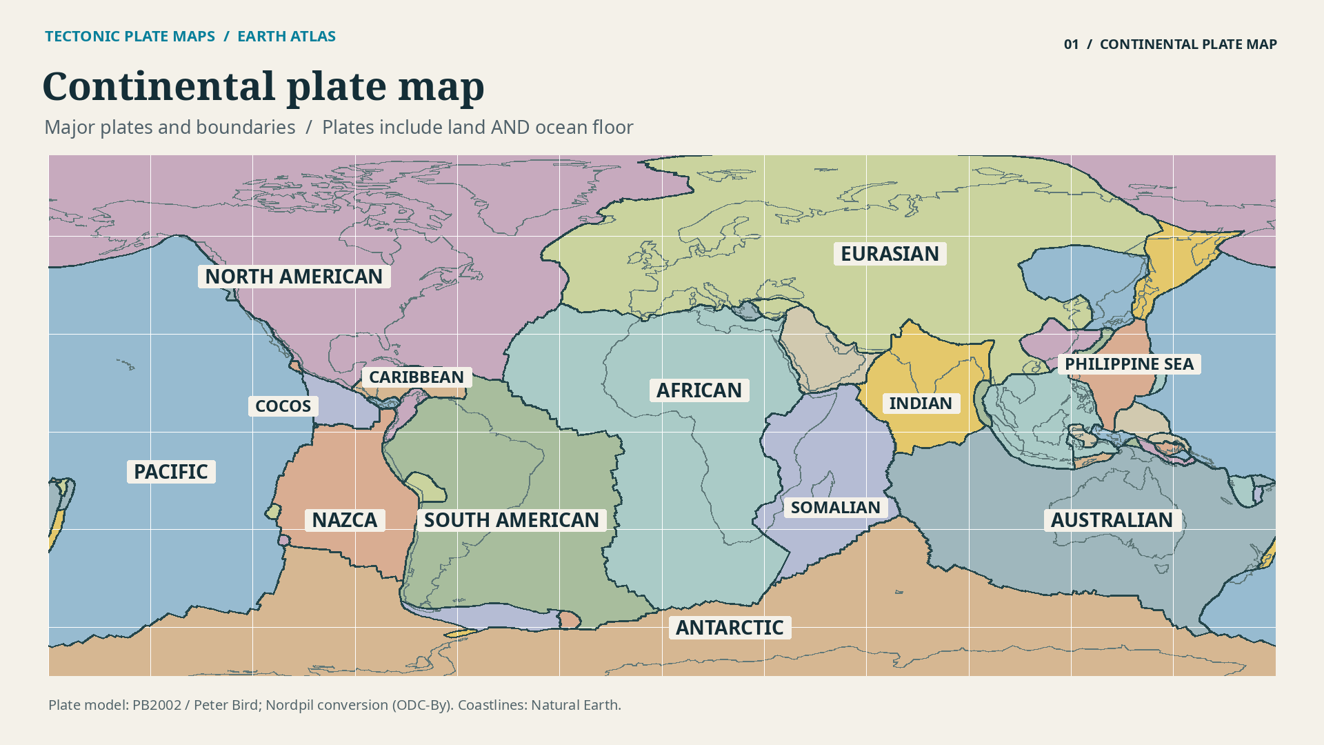
Start with the plate under your location, then follow its boundary. A tectonic plate includes land, ocean floor, or both. Its edge is not necessarily a coastline. For example, the South American Plate extends from the continent into the Atlantic Ocean.
Use the selector to find a plate, switch labels on or off, and compare boundaries with recorded earthquakes. The earthquake layer shows USGS events of magnitude 6.0 or greater in 2025; it is not a live feed or a forecast.
The Pacific, North American, South American, Eurasian, African, Australian and Antarctic plates cover much of the world. This detailed model also separates India and includes smaller plates such as Nazca, Cocos, Caribbean and Philippine Sea.
Some school maps combine India and Australia. A geological plates map can therefore show a different plate count depending on its model and level of detail. What matters is understanding the boundaries, not memorising one universal total.
Watch Tectonic Plate Maps on YouTube ↗READ THE MOVEMENT
Plates move apart and new oceanic crust can form. The Mid-Atlantic Ridge is a clear example.
Plates move together. Subduction occurs off South America; continental collision helps build the Himalayas.
Plates slide past each other. California's San Andreas Fault system follows part of a transform boundary.
WATCH THE MAP EXPLAINED
Follow the major plates, see how the three boundary types move, and connect the map with mountains and earthquake zones.
Watch on YouTube ↗Plate geometry: Peter Bird's PB2002 model, converted by Hugo Ahlenius / Nordpil, under the Open Data Commons Attribution licence. Coastlines: Natural Earth, public domain. Earthquakes: USGS earthquake catalogue, retrieved 11 October 2026. Explanations: USGS, Understanding plate motions.
Boundary lines are a global-scale model. Real deformation can span broad zones, and earthquakes also occur inside plates. This map is for exploration and education, not site-specific hazard assessment. Boundary types are explained below the map; the map's line colour does not classify every boundary.